Manaaki Whenua-Landcare Research, the University of Waikato, and the Natural Resource Conservation Service of the United States Department of Agriculture maintain a network of soil-climate stations in the Ross Sea region of Antarctica. The network is comprised of nine soil-permafrost climate stations that monitor temperatures to 1.2 m depth plus two 30 m deep permafrost monitoring temperature boreholes.
The data is the largest long-running continuous soil-permafrost temperature monitoring data set in Antarctica with some soil climate stations collecting data since 1999. In that regard their value increases with the length of the record as we can start to see medium-term trends. As the temperature data extends into the permafrost it makes it possible to accurately determine active layer depth (the depth of summer thaw). The depth of the active layer is a good integrator of all the highly variable climate patterns so has potential to identify real, long-term effects of climate on soil temperature.
Understanding soil/permafrost temperature is a key tenant of establishing the effects of climate change on soil and permafrost properties. This baseline data has potential to be used in comparison with other shorter term temperature data capture to extrapolate across the wider terrain and extend, calibrate, and verify soil temperature model.
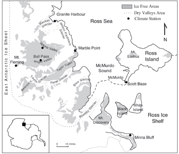
Map of the Ross Sea region of Antarctica showing the locations of the soil climate stations (Seybold et al. 2009)
The soil climate stations provide both a latitudinal and altitudinal gradient across the Ross Sea region. The coastal sequence ranges from Minna Bluff (78°30’41.6”S) (colder, windier, and some distance from the open sea), through Scott Base and Marble Point, to Granite Harbour (77°00’23.7”S). The Granite Harbour site was located to capture the unique sheltered environment that is of importance as it relates to the unusually lush biological growth of Botany Bay. To complement the coastal latitudinal sequence we have an altitudinal sequence ranging from Marble Point (60 m.a.s.l) through Wright Valley (160 m.a.s.l) and Victoria Valley (410 m.a.s.l) to Mt Fleming (1700 m.a.s.l) which includes the valley floor environment through to the margin of the polar plateau. Then to capture the valley walls and intermediate altitude, particularly to support some of the modelling efforts, we have relatively recently installed two further sites – one on a terrace above Don Juan Pond and the other on the high Wright Valley wall east of the entrance to Bull Pass. The 30 m boreholes are in bedrock, one at Marble Point to capture the coastal environment and one on the floor of the Wright Valley to capture the more extreme dry climate. Overall, we now have a functioning network that uniquely captures on the range of soil active layer and permafrost environments in the McMurdo Dry Valleys region.
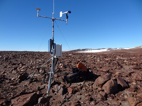
Mt Fleming soil climate station, top of the Wright Valley at 1700 m above sea level
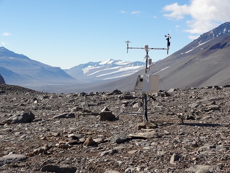
Don Juan Pond soil climate station, Wright Valley wall